


Meteorological Emergency Response Vehicle
General Description
The Model MERV-8000 Meteorological Emergency Response Vehicle is a self-contained mobile meteorological system. The MERV-8000 is ideal for quick deployment in support of Homeland Security or any other natural disaster requiring mobile real-time weather observations.
The MERV-8000 can be used by emergency management, military, or researchers. Unskilled personnel can set up and operate the system with minimal training. A trained meteorologist is not needed.
Features
Fully automated operation
Internet connectivity for remote control and remote monitoring
Surface measurements
Boundary layer measurements
Full upper air radiosonde capability
Data output in graphical, text, and standard meteorological formats to support near real-time operations
GPS and Loran tracking of radiosondes
Applications
Homeland Security - nuclear, chemical, and biological hazard corridor determination
Complete back up weather observation system after natural disasters such as hurricanes, severe weather, earthquakes
Volcanic ash cloud monitoring
Air pollution monitoring/studies
Toxic dispersion forecasting
Field experiments for research
Forest fire weather support

MERV-8000 Meteorological Emergency Response Vehicle – Truck Mounted

MERV-8000 Meteorological Emergency Response Vehicle – Trailer Mounted
Principle of Operation
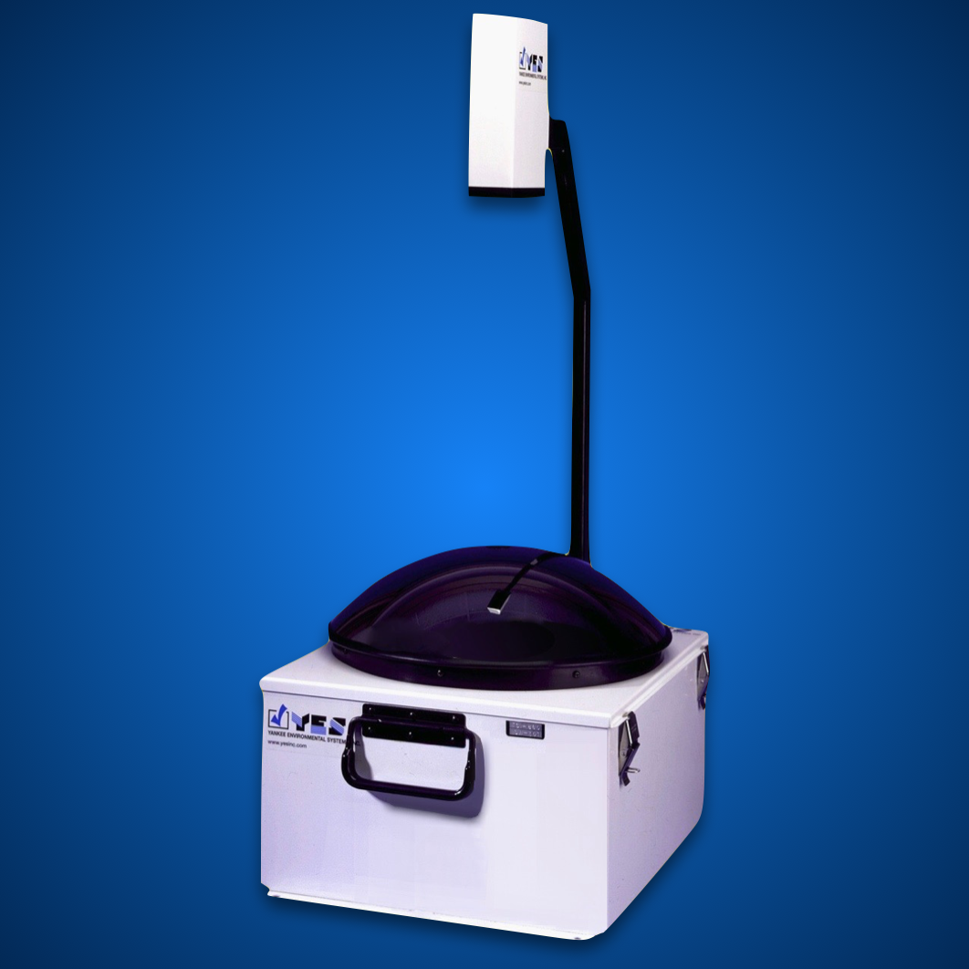
The MERV-8000’s core technology is a self-contained meteorological balloon inflation and launch shelter that can automatically launch up to 8 radiosondes at predetermined intervals. A radiosonde is a small sensor package that measures temperature, humidity, pressure, wind speed and wind direction as it ascends through the atmosphere tethered to a helium-filled balloon. The environmental data is sent to a ground station via a radio transmitter in the radiosonde in near real-time for processing.

Balloon and radiosonde in flight. The radiosonde is tethered to the balloon by about 100 ft of string.
The vehicle includes a surface weather station Model TMS-7000 that includes sensors for temperature, humidity, pressure, wind, and solar radiation. These sensors can be mounted on the vehicle or a short distance away via a tripod.

Thermohygrometer with pressure sensor mounted on back of MERV provides surface temperature, dew point, and barometric pressure.

Anemometer and wind vane mounted on roof of MERV provides surface wind speed and direction.
The MERV-8000 radiosonde system allows users to automatically release up to 8 radiosondes at user selected times. This can be done on-site or remotely. The radiosonde system works in conjunction with the other sensors that are all data logged in the YESDAS (Yankee Environmental Systems Data Acquisition System). All systems are accessed via a web browser and the data is presented using the YESDAQ Data Visualization Software. The data can then be ingested into most atmospheric models for various emergency applications.
Emergency Management Support
Knowing "which way the wind is blowing" is not necessarily a simple parameter that emergency managers can use to get people out of harms way. The atmosphere is three-dimensional which means toxins/particulates can be dispersed and transported vertically as well as horizontally. Most toxins are released in the Boundary Layer. The boundary layer is defined as the lowest 3000 m (10,000 ft) of the atmosphere but is quite variable and can be as low as a few hundred meters (1,500 ft). Toxins in the boundary layer are transported horizontally by the mean wind speed and direction and vertically by turbulence. On a hot summer day, more toxins may be transported vertically than horizontally. This is just one reason why only measuring the surface winds will not provide enough information to make informed decisions about the "toxic corridor" that emanates from the source of the toxic substance. By using a radiosonde in conjunction with surface instrumentation, the vertical transport as well as the horizontal transport can be identified. Graphical and textual data can be viewed for every radiosonde launched from the MERV and then formatted for use in weather prediction models.

Graphical display of radiosonde data showing temperature and dew point versus height. "Turbulence" parameters are shown in the upper right hand corner of chart.
The "turbulence" parameters are computed for every radiosonde flight providing an indication of the amount of unstable air present. These parameters are useful to help determine how much mixing of the air is taking place and may provide some information on the surface concentration of the toxin.
When the air is stable, the boundary layer is shallow and can create a low altitude vertical "cap" forcing the toxins to remain trapped and concentrated near the ground and near the source.

Wind flow in a stable atmosphere showing a high concentration near the ground.
When the air is unstable, the boundary layer is deep and allows the toxins to rise higher in the atmosphere resulting in less concentration near the ground. The toxins are more widely dispersed, especially vertically.

Wind flow in an unstable atmosphere lifts the toxin into the atmosphere resulting in less concentration near the surface.
When the air is neutrally unstable, the boundary layer is not shallow and there is little vertical motion (rising air). This keeps the toxins relatively low in the atmosphere resulting in less concentration near the source but dispersion over a larger area. The toxins are typically carried further downwind of the source.

Wind flow in a neutrally stable atmosphere allows the toxins to be carried further from the source by the mean horizontal wind.
Optional Sensors
Besides a full radiosonde vertical profile, an optional Model ATW-9500 Automated Tetheredsonde Winch can be deployed with the MERV to provide continuous and instantaneous temperature, humidity, and winds every 250 meters up 1500 meters altitude.
Also available as an option is the Model TDL-6200 Total Doppler Lidar. For u, v, and w winds up to a few kilometers altitude, the TDL-6200 provides remote sensing of wind speed and direction while operating in the intrinsically eye-safe and invisible 1.5μ m near infrared (NIR) region. Its solid state laser diode source and erbium-doped fiber amplifier provides reliable, continuous service at remote locations.
| Specifications |
|
Operating Temperature -40° C to +44° C |
|
Weight/Size 3220 lbs. 8’ long x 6.5’ wide x 8’ high |
|
Power Requirements 115/230 Vac |
|
Wind Speed Limits ≤ 45 mph |
Note: Specifications subject to change without notice.